Getting started with...
OGC WEB COVERAGE SERVICE (WCS)
BUT - before we start...
who is familiar with WMS?
who knows WCS?
who has already worked with WCS?
The Web Coverage Service is defined by the Open Geospatial Consortium (OGC) (2012):
The OGC WCS supports electronic retrieval of geospatial data as 'coverages' -
that is, digital geospatial information representing space/time varying phenomena
Therefore, WCS is a standard data -access protocol that defines and enables web-based retrieval of multi-dimensional geospatial datasets.
Let's picture WCS within in the common OGC web service suite...

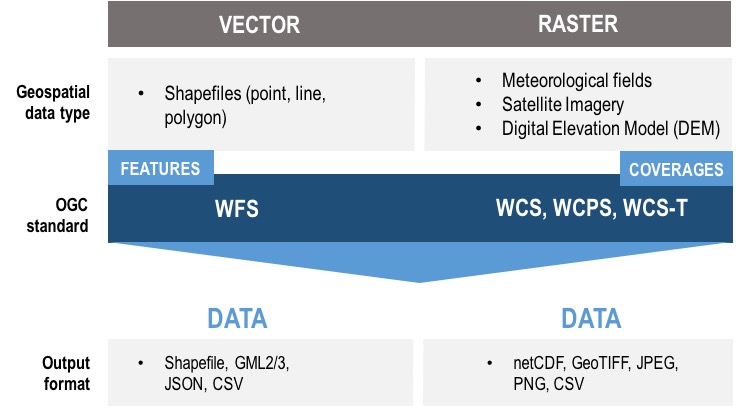
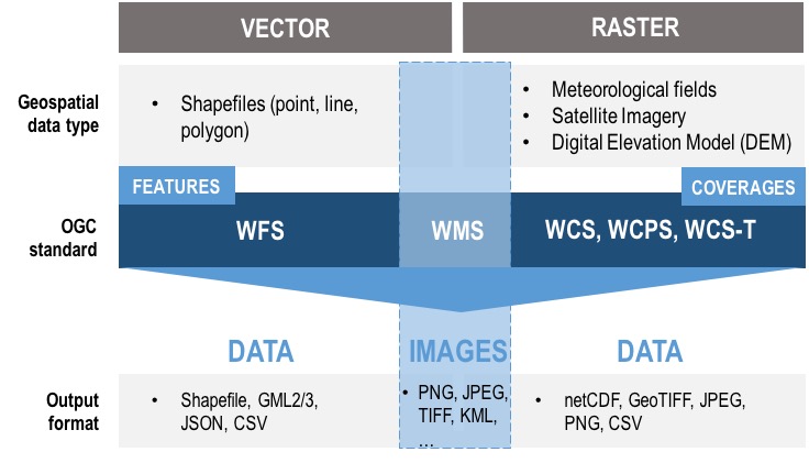
Unlike Web Mapping Service (WMS), which returns spatial data as an image, WCS returns data in its raw form, with its original semantics.
This allows for further web-based data processing or the building of web applications.
What about WCPS?
A Web Coverage Processing Service (WCPS) is an extension supported by the WCS 2.0 core specification and can optionally be implemented by a WCS server.
Enough theory... Let's see how it looks like in real...