2.1.2. Synthetic - Data Gridding
As explained in the Synthetic - Data Gridding section, magnetic data should be gridded prior to applying transforms and filters. This means that the flight line data must be interpolated on a regular 2D grid.
To run the widget, select each cell below (greyed boxes below with "## Load all libraries..." and "view = Simulator.dataGriddingWidget...") and press [Shift+Enter], or select each cell and click on the 'Run' button in the menu at the top of the notebook. 
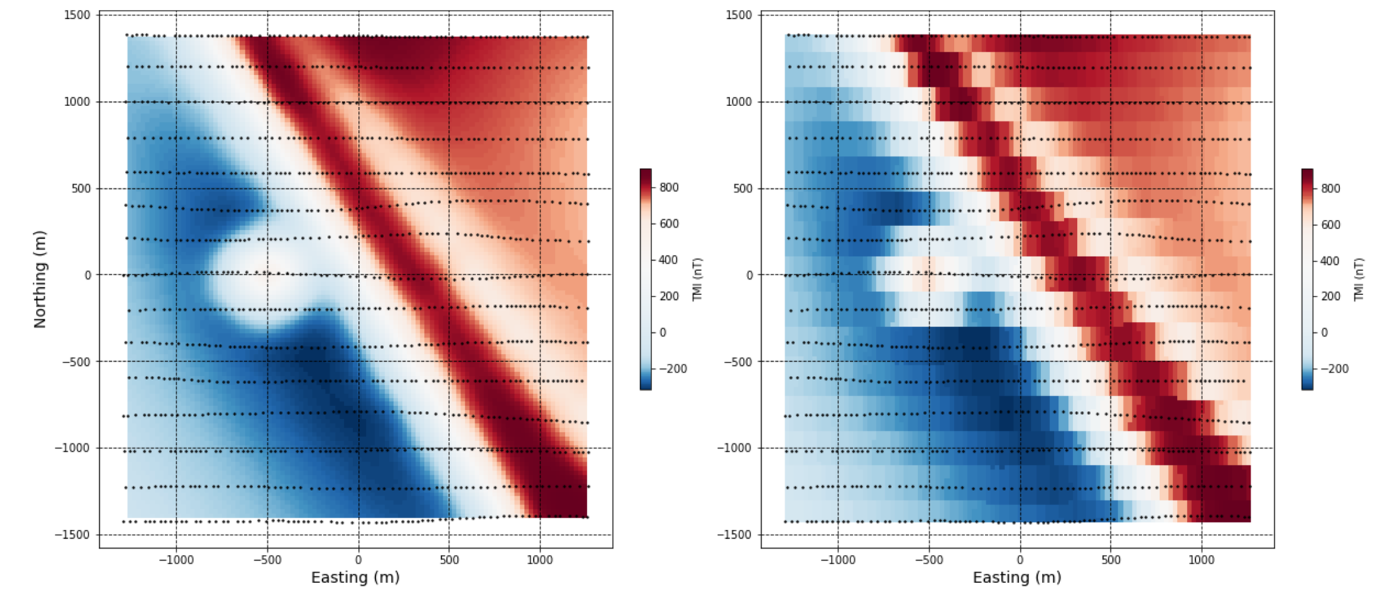
The resulting gridded data shows the larger and smaller magnetic bodies, and the magnetic low related to the northwest trending structure cross-cutting the larger magnetic domain.
Try changing the grid cell size in the box labelled 'Grid (m)', and view the result of gridding using the four different methods listed in the drop down menu labelled 'Method'.
## Load all libraries and setup the synthetic problem
from GeoToolkit.Mag import Mag, ProblemSetter, MathUtils, Simulator, DataIO
import numpy as np

survey = np.loadtxt("./assets/TKC/Synthetic_Forward_TMI.dat")
view = Simulator.dataGriddingWidget(
    survey, saveAs="./Output/DataGrid", dataColumn=4,
    Method="minimumCurvature", omit=["EPSGcode","GetIncDec","saveAs","SaveGrid"],
    shapeFile='./assets/Synthetic/Synthetic_Zcontours.shp')
display(view)