![]()
Getting started
~ déjà vu ~ if you haven't already done so: You need your own copy of this notebook. Go to "File" and 'save a copy in github' (give access if needed.... put it into the repository you made for this course). Now you have your own copy of the notebook. Click 'open in colab' to get started working on the practical exercise.
Interactive maps and looking more at distributions
~ déjà vu ~ Last week, we focused on making "mostly static" maps, that is maps where you mostly just expect your user to look at the end-product, the map, you've prepared. We looked at a research question visualizing the distribution of Iron Age sites in Central Italy, and we focused the practical exercise on using the map for:
- data exploration => filtering and creating subsets of data to show different aspects of the overall dataset, one at a time
- visualisation => zoom level (visual balance), visual variables (symbols, fonts, generalisation, color)
- organisation => Balancing geospatial and attribute (descriptive) data, and which attributes will be emphasized in a given map
~ new ~ This week we'll continue exploring different types of maps. Specifically, we'll look at making maps where interactivity is a key part of the design. We'll see how interactivity allows you to include more variables and more information in a single map.
Beyond the question of how to present spatial data (i.e. designing the map), we will spend time on an important topic in archaeology: spatial distributions. Spatial distributions are patterns in space. Are things clustered together or spaced out regularly or randomly distributed?
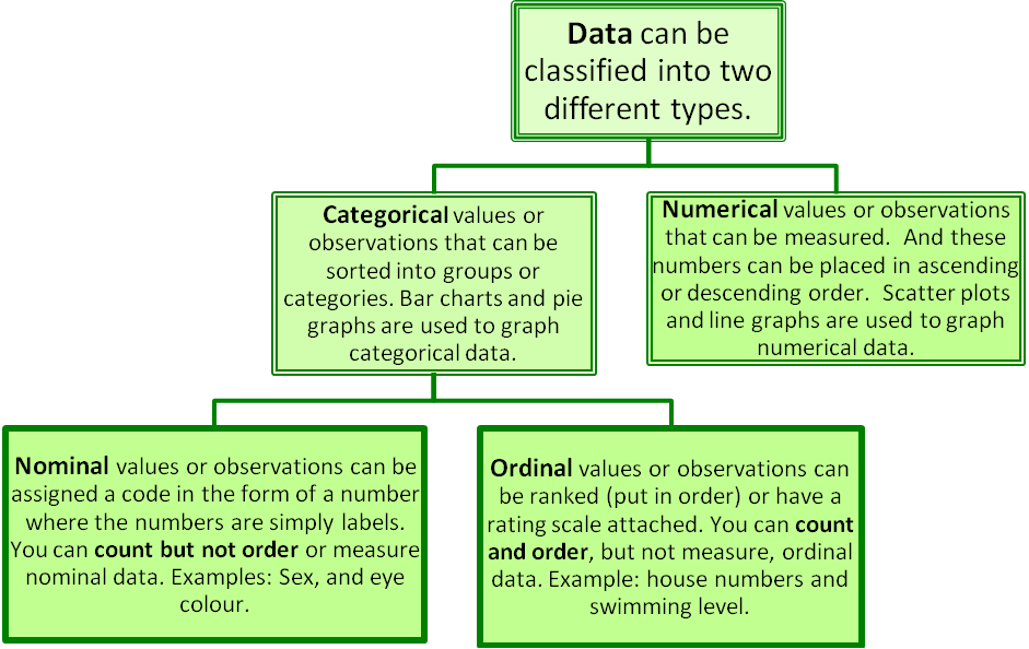
Types of Distribution: Data Sampling

Examples of Applications

Central to investigating spatial distributions (patterns) is our ability to manipulate and rearrange spatial data, as we work to answer spatially explicit questions.
This practical lab will provide you ways to do so through:
- transforming database
- merging database
- creating layers